
Thank you for supporting this site ❤️
Make a donation
Make a donation
Saint Martin Island topographic map
Click on the map to display elevation.
Thank you for supporting this site ❤️
Make a donation
Make a donation
About this map
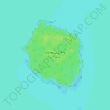
Name: Saint Martin Island topographic map, elevation, terrain.
Average elevation: 176 m
Minimum elevation: 172 m
Maximum elevation: 184 m
Thank you for supporting this site ❤️
Make a donation
Make a donation
Other topographic maps
Click on a map to view its topography, its elevation and its terrain.
Bois Blanc Island
United States > Michigan > Mackinac County > Bois Blanc Township
Average elevation: 179 m
Thank you for supporting this site ❤️
Make a donation
Make a donation
Thank you for supporting this site ❤️
Make a donation
Make a donation
Thank you for supporting this site ❤️
Make a donation
Make a donation
Thank you for supporting this site ❤️
Make a donation
Make a donation