Geolocate

Sarawadi topographic map

Interactive map

Click on the map to display elevation.

About this map

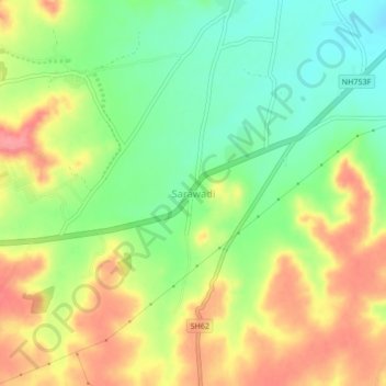
Name: Sarawadi topographic map, elevation, terrain.

Location: Sarawadi, Shirur, Maharashtra, 412210, India (18.78020 74.30835 18.82020 74.34835)

Average elevation: 604 m

Minimum elevation: 565 m

Maximum elevation: 647 m

Other topographic maps

Click on a map to view its topography, its elevation and its terrain.

Pabal

India > Maharashtra > Shirur

Pabal, Shirur, Pune, Maharashtra, 412403, India

Average elevation: 681 m

Koregaon

India > Maharashtra > Shirur

Koregaon, Shirur, Maharashtra, 412216, India

Average elevation: 553 m

Shikrapur

India > Maharashtra > Shirur > Shikrapur

Shikrapur, Shirur, Pune District, Maharashtra, 412208, India

Average elevation: 581 m