
Gapyeong topographic map
Interactive map
Click on the map to display elevation.
About this map
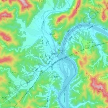
Name: Gapyeong topographic map, elevation, terrain.
Location: Gapyeong, Gapyeong-gun, Gyeonggi, 12419, South Korea (37.78534 127.47661 37.86534 127.55661)
Average elevation: 157 m
Minimum elevation: 43 m
Maximum elevation: 481 m