
Boussu-Bois topographic map
Interactive map
Click on the map to display elevation.
About this map
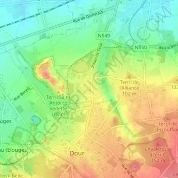
Name: Boussu-Bois topographic map, elevation, terrain.
Location: Boussu-Bois, Boussu, Bergen, Henegouwen, Wallonië, 7300, België (50.39079 3.76298 50.43079 3.80298)
Average elevation: 68 m
Minimum elevation: 26 m
Maximum elevation: 127 m
Other topographic maps
Click on a map to view its topography, its elevation and its terrain.
Boussu
België > Henegouwen > Bergen > Boussu
Boussu, Bergen, Henegouwen, Wallonië, 7300, België
Average elevation: 46 m