
泸山 topographic map
Interactive map
Click on the map to display elevation.
About this map
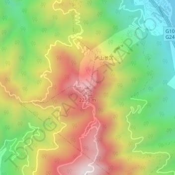
Name: 泸山 topographic map, elevation, terrain.
Location: 泸山, 西昌市, 凉山彝族自治州, 四川省, 中国 (27.82647 102.25993 27.82657 102.26003)
Average elevation: 1,893 m
Minimum elevation: 1,511 m
Maximum elevation: 2,324 m
Other topographic maps
Click on a map to view its topography, its elevation and its terrain.