
Ballı topographic map
Interactive map
Click on the map to display elevation.
About this map
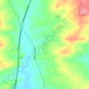
Name: Ballı topographic map, elevation, terrain.
Location: Ballı, Malkara, Tekirdağ, Marmara Bölgesi, Turquie (40.81042 27.03470 40.85042 27.07470)
Average elevation: 151 m
Minimum elevation: 102 m
Maximum elevation: 229 m