
KG Leopoldstadt topographic map
Interactive map
Click on the map to display elevation.
About this map
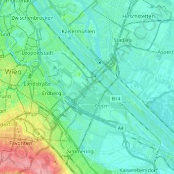
Name: KG Leopoldstadt topographic map, elevation, terrain.
Location: KG Leopoldstadt, Leopoldstadt, Wien, 1020, Österreich (48.16529 16.36746 48.23637 16.49515)
Average elevation: 171 m
Minimum elevation: 150 m
Maximum elevation: 253 m
Other topographic maps
Click on a map to view its topography, its elevation and its terrain.
Donaustadt
Österreich > Wien > Neukagran
Donaustadt, Neukagran, Wien, 1220, Österreich
Average elevation: 161 m