Ledong topographic map
Interactive map
Click on the map to display elevation.
About this map

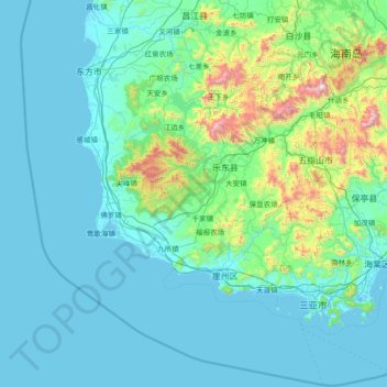
Name: Ledong topographic map, elevation, terrain.
Location: Ledong, Hainan Province, China (17.95028 108.34917 19.35028 109.74917)
Average elevation: 176 m
Minimum elevation: -3 m
Maximum elevation: 1,772 m
Other topographic maps
Click on a map to view its topography, its elevation and its terrain.

Sanya City
Sanya lies at the southern tip of Hainan Island on Sanya Bay. Located at 18° 15' N latitude, Sanya is–after Sansha (also administered by Hainan Province)–the second-southernmost prefecture-level city nationally. Though the administrative area (Sanya City) has a rough topography, the city itself is…
Average elevation: 168 m

NorthEast SCS
The Philippines state that its assertion of sovereignty over the shoal is based on the juridical criteria established by public international law on the lawful methods for the acquisition of sovereignty. Among the criteria (effective occupation, cession, prescription, conquest, and accretion), the Philippine…
Average elevation: 0 m