
Poppenhausen topographic map
Interactive map
Click on the map to display elevation.
About this map
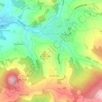
Name: Poppenhausen topographic map, elevation, terrain.
Location: Poppenhausen, Landkreis Fulda, Hessen, 36163, Deutschland (50.46872 9.85457 50.49743 9.89690)
Average elevation: 529 m
Minimum elevation: 417 m
Maximum elevation: 675 m