
Thank you for supporting this site ❤️
Make a donation
Make a donation
Hurricane topographic map
Click on the map to display elevation.
Thank you for supporting this site ❤️
Make a donation
Make a donation
About this map
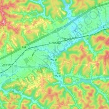
Name: Hurricane topographic map, elevation, terrain.
Location: Hurricane, Putnam County, West Virginia, United States (38.39422 -82.05144 38.45741 -81.97254)
Average elevation: 237 m
Minimum elevation: 184 m
Maximum elevation: 324 m
Thank you for supporting this site ❤️
Make a donation
Make a donation
Other topographic maps
Click on a map to view its topography, its elevation and its terrain.