
Sukoró topographic map
Interactive map
Click on the map to display elevation.
About this map
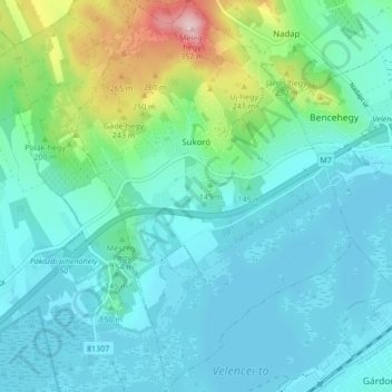
Name: Sukoró topographic map, elevation, terrain.
Average elevation: 148 m
Minimum elevation: 101 m
Maximum elevation: 345 m
Other topographic maps
Click on a map to view its topography, its elevation and its terrain.
Csabdi
Hongarije > Fejér megye > Csabdi
Csabdi, Bicskei járás, Fejér megye, Centraal-Transdanubië, Transdanubië, 2064, Hongarije
Average elevation: 214 m