
Mulgama topographic map
Interactive map
Click on the map to display elevation.
About this map
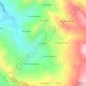
Name: Mulgama topographic map, elevation, terrain.
Location: Mulgama, Kandy District, Central Province, 20544, Sri Lanka (7.13458 80.65095 7.17458 80.69095)
Average elevation: 974 m
Minimum elevation: 643 m
Maximum elevation: 1,419 m