
Hyoja-dong topographic map
Interactive map
Click on the map to display elevation.
About this map
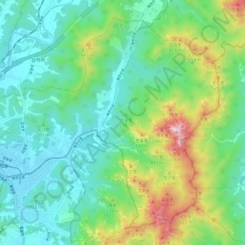
Name: Hyoja-dong topographic map, elevation, terrain.
Location: Hyoja-dong, Deogyang-gu, Goyang-si, Gyeonggi, South Korea (37.62937 126.90126 37.69302 126.99427)
Average elevation: 233 m
Minimum elevation: 23 m
Maximum elevation: 810 m