
Thank you for supporting this site ❤️
Make a donation
Make a donation
Mulugu topographic map
Click on the map to display elevation.
Thank you for supporting this site ❤️
Make a donation
Make a donation
About this map
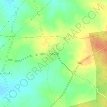
Name: Mulugu topographic map, elevation, terrain.
Location: Mulugu, Mulug mandal, Siddipet, Telangana, India (17.72369 78.60977 17.76369 78.64977)
Average elevation: 597 m
Minimum elevation: 579 m
Maximum elevation: 618 m
Thank you for supporting this site ❤️
Make a donation
Make a donation
Other topographic maps
Click on a map to view its topography, its elevation and its terrain.