
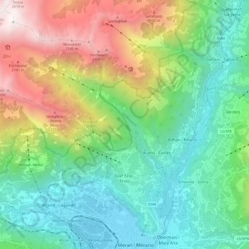
Tirol - Tirolo topographic map
Interactive map
Click on the map to display elevation.
About this map
Name: Tirol - Tirolo topographic map, elevation, terrain.
Average elevation: 1,178 m
Minimum elevation: 295 m
Maximum elevation: 2,765 m
Other topographic maps
Click on a map to view its topography, its elevation and its terrain.
Dorf Tirol - Tirolo
Italië > Trento-Zuid-Tirol > Tirol - Tirolo > Dorf Tirol - Tirolo
Dorf Tirol - Tirolo, Tirol - Tirolo, Burggrafenamt - Burgraviato, Bolzano - Bozen, Trento-Zuid-Tirol, 39019, Italië
Average elevation: 610 m