
Make a donation
Maunatlala topographic map
Click on the map to display elevation.
Make a donation
Maunatlala
As time passed by Kgosi Mapena’s eldest son who was named Maunatlala died, the village’ name was changed from Kopung to Maunatlala. Climatic Conditions The climate of Maunatlala area is semi-arid with dry winters and fairly wet summer months, with drought endemic. The average precipitation for the area is 440 mm. the minimum temp in the region ranges between 12.5 and 6 degrees Celsius. Maximum temperatures range between 21.5 and 40.5. Like the rest of the country, evaporation is very high and far exceeds rainfall. Data from Mahalapye meteorological station shows wind directions to be fairly constant throughout the year. Strong winds occur in association with thunderstorms during rainy season. Occasionally peak speeds of over50knots are recorded. Data shows that such winds are generally short lived. Topography The estimate terrain elevation above sea level of the village is 856 meters, with Tswapong hills which have a plateau of 1310 meters above sea level. From the base of these hills the flood plains of the ephemeral Lotsane River gently northwards the river channel. A number of small washes and gullies emanating from the Tswapong Hills run across the flood plains towards the Lotsane River. Hydrology The village of Maunatlala falls under the Limpopo drainage basin which the Lotsane River forms a part. The total drainage area to the confluence with the Limpopo river is 15 790 cubic meters. The Lotsane River provides inflow to the Lotsane Dam in Maunatlala Village. Vegetation The dominant vegetation in the area is a mixed shrub and tree savannah with increasing tree density in connection with vegetation type found on hills and rivers. The type of tree savannah found on hills and rocky outcrops can broadly be divided into two; these are Moologa and Mokoba. The larger Mopane trees tend to grow on the inclines. Animal Life Cattle and goats dominate the large herbivore biomass in the Lotsane catchment area. Migratory wild ungulates such as wildebeest and hartebeest have perished and are now excluded from the area by extensive human acts throughout the region. Elephants are not found in the immediate area, but are known to occur further east. The Department of National Parks and Wildlife Ariel surveys reveal that the wild ungulate population is made up of Kudu, Impala, duiker and steenbok in low numbers, with warthog also present. Demography According to 2011 Housing and Population Census there were 4552 people in the village of Maunatlala and 4951 in Maunatlala and its associated localities. Maunatlala is second largest settlement in the Lerala-Maunatlala Constituency in terms of population size. The population of this settlement has grown by over 43% since 2001 an annual increase of around 4.3%. Economic Activity The economically active population comprises all persons of either sex who furnish the supply of labour for the production of goods and services during a specified period of time-reference period. According to Central Statistics Office (2011) most employees in Maunatlala are paid in cash and they constitute 21.8 % of the people. The Self-employed represent around 1.8 % of total active population.
Make a donation
About this map
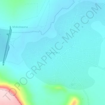
Name: Maunatlala topographic map, elevation, terrain.
Location: Maunatlala, Central District, Botswana (-22.61554 27.61207 -22.57554 27.65207)
Average elevation: 878 m
Minimum elevation: 837 m
Maximum elevation: 1,149 m
Make a donation
Other topographic maps
Click on a map to view its topography, its elevation and its terrain.