
San Luis Potosí topographic map
Interactive map
Click on the map to display elevation.
About this map
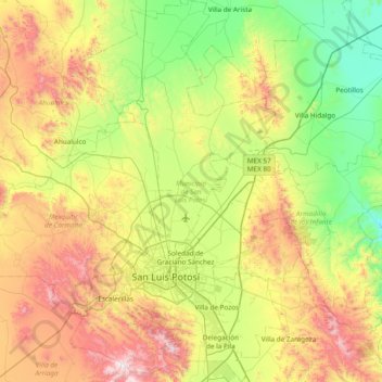
Name: San Luis Potosí topographic map, elevation, terrain.
Location: San Luis Potosí, México (21.95761 -101.16851 22.66066 -100.74204)
Average elevation: 1,938 m
Minimum elevation: 1,442 m
Maximum elevation: 2,847 m