
Kerna topographic map
Interactive map
Click on the map to display elevation.
About this map
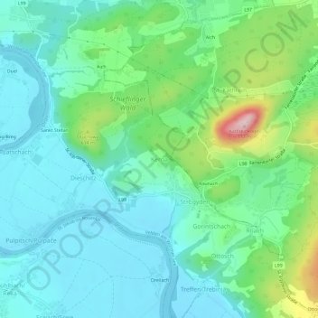
Name: Kerna topographic map, elevation, terrain.
Average elevation: 529 m
Minimum elevation: 459 m
Maximum elevation: 752 m
Other topographic maps
Click on a map to view its topography, its elevation and its terrain.
Bach
Oostenrijk > Karinthië > Bezirk Villach-Land > Velden am Wörther See > Lamp
Bach, Lamp, Velden am Wörther See, Bezirk Villach-Land, Karinthië, 9232, Oostenrijk
Average elevation: 539 m
Treffen/Trebinja
Oostenrijk > Karinthië > Bezirk Villach-Land > Velden am Wörther See > Treffen/Trebinja
Treffen/Trebinja, Velden am Wörther See, Bezirk Villach-Land, Karinthië, 9536, Oostenrijk
Average elevation: 524 m