
Thank you for supporting this site ❤️
Make a donation
Make a donation
Llanellen topographic map
Click on the map to display elevation.
Thank you for supporting this site ❤️
Make a donation
Make a donation
About this map
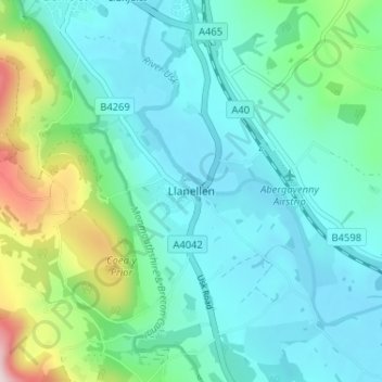
Name: Llanellen topographic map, elevation, terrain.
Location: Llanellen, Monmouthshire, Wales, NP7 9HR, United Kingdom (51.77283 -3.03045 51.81283 -2.99045)
Average elevation: 121 m
Minimum elevation: 37 m
Maximum elevation: 452 m
Thank you for supporting this site ❤️
Make a donation
Make a donation
Other topographic maps
Click on a map to view its topography, its elevation and its terrain.
Thank you for supporting this site ❤️
Make a donation
Make a donation
Thank you for supporting this site ❤️
Make a donation
Make a donation