
Thank you for supporting this site ❤️
Make a donation
Make a donation
Bashkia Kukës topographic map
Click on the map to display elevation.
Thank you for supporting this site ❤️
Make a donation
Make a donation
About this map
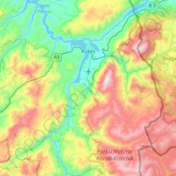
Name: Bashkia Kukës topographic map, elevation, terrain.
Location: Bashkia Kukës, Kukës County, Northern Albania, Albania (41.81476 20.12996 42.18205 20.62659)
Average elevation: 1,057 m
Minimum elevation: 276 m
Maximum elevation: 2,462 m
Thank you for supporting this site ❤️
Make a donation
Make a donation