
Schwanden topographic map
Interactive map
Click on the map to display elevation.
About this map
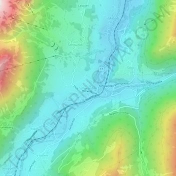
Name: Schwanden topographic map, elevation, terrain.
Location: Schwanden, Glarus, 8762, Schweiz (46.97556 9.05136 47.01556 9.09136)
Average elevation: 813 m
Minimum elevation: 498 m
Maximum elevation: 1,744 m