
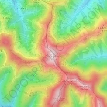
Schnebelhorn topographic map
Interactive map
Click on the map to display elevation.
About this map
Name: Schnebelhorn topographic map, elevation, terrain.
Location: Schnebelhorn, Fischenthal, Bezirk Hinwil, Zurigo, 9613, Svizzera (47.32559 8.97955 47.32569 8.97965)
Average elevation: 1,025 m
Minimum elevation: 800 m
Maximum elevation: 1,268 m