
Thank you for supporting this site ❤️
Make a donation
Make a donation
Baxter Island topographic map
Click on the map to display elevation.
Thank you for supporting this site ❤️
Make a donation
Make a donation
About this map
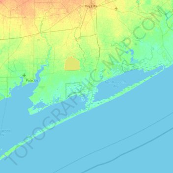
Name: Baxter Island topographic map, elevation, terrain.
Location: Baxter Island, Matagorda County, Texas, 77415, United States (28.36360 -96.30746 29.00360 -95.66746)
Average elevation: 4 m
Minimum elevation: -3 m
Maximum elevation: 22 m
Thank you for supporting this site ❤️
Make a donation
Make a donation
Other topographic maps
Click on a map to view its topography, its elevation and its terrain.