
Thiruvaniyoor topographic map
Interactive map
Click on the map to display elevation.
About this map
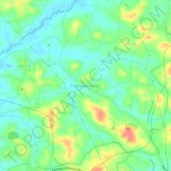
Name: Thiruvaniyoor topographic map, elevation, terrain.
Location: Thiruvaniyoor, Kunnathunad, Ernakulam, Kerala, 682308, India (9.91392 76.40481 9.95392 76.44481)
Average elevation: 27 m
Minimum elevation: 4 m
Maximum elevation: 71 m
Other topographic maps
Click on a map to view its topography, its elevation and its terrain.