
Bancroft topographic map
Interactive map
Click on the map to display elevation.
About this map
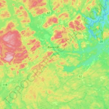
Name: Bancroft topographic map, elevation, terrain.
Location: Bancroft, Hastings County, Central Ontario, Ontario, Canada (44.95205 -77.90515 45.13624 -77.63016)
Average elevation: 370 m
Minimum elevation: 283 m
Maximum elevation: 518 m