Geolocate

Malviya Nagar topographic map

Interactive map

Click on the map to display elevation.

About this map

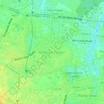
Name: Malviya Nagar topographic map, elevation, terrain.

Location: Malviya Nagar, Hauz Khas Tehsil, South Delhi, Delhi, India (28.52870 77.20589 28.53912 77.21917)

Average elevation: 229 m

Minimum elevation: 218 m

Maximum elevation: 239 m

Other topographic maps

Click on a map to view its topography, its elevation and its terrain.

Shivalik

India > Delhi > Hauz Khas Tehsil

Shivalik, Hauz Khas Tehsil, South Delhi District, Delhi, India

Average elevation: 230 m

Khanpur

India > Delhi > Hauz Khas Tehsil

Khanpur, Hauz Khas Tehsil, South Delhi, Delhi, 110062, India

Average elevation: 235 m

Saket

India > Delhi > Hauz Khas Tehsil

Saket, Hauz Khas Tehsil, South Delhi, Delhi, India

Average elevation: 231 m

Sadhna Enclave

India > Delhi > Hauz Khas Tehsil

Sadhna Enclave, Bhavishya Nidhi Enclave, Hauz Khas Tehsil, South Delhi, Delhi, 110017, India

Average elevation: 227 m

Hauz Khas

India > Delhi > Hauz Khas Tehsil

Hauz Khas, Hauz Khas Tehsil, South Delhi, Delhi, India

Average elevation: 225 m

Hauz Rani

India > Delhi > Hauz Khas Tehsil

Hauz Rani, Hauz Khas Tehsil, South Delhi, Delhi, 110017, India

Average elevation: 230 m

Sanjay Van

India > Delhi > Hauz Khas Tehsil > New Delhi

Sanjay Van, Vasant Vihar Tehsil, New Delhi, Hauz Khas Tehsil, South Delhi, Delhi, India

Average elevation: 246 m