
Baarlo topographic map
Interactive map
Click on the map to display elevation.
About this map
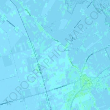
Name: Baarlo topographic map, elevation, terrain.
Location: Baarlo, Steenwijkerland, Overijssel, Nederland (52.71755 5.93015 52.75272 5.97846)
Average elevation: 0 m
Minimum elevation: -4 m
Maximum elevation: 4 m
Other topographic maps
Click on a map to view its topography, its elevation and its terrain.
Nationaal Park Weerribben-Wieden
Nederland > Overijssel > Steenwijkerland
Nationaal Park Weerribben-Wieden, Overijssel, Nederland
Average elevation: 1 m
Belterwijde
Nederland > Overijssel > Steenwijkerland
Belterwijde, Veneweg, Wanneperveen, Steenwijkerland, Overijssel, Nederland, 7946LN, Nederland
Average elevation: 0 m