
Splügen topographic map
Interactive map
Click on the map to display elevation.
About this map
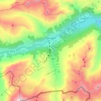
Name: Splügen topographic map, elevation, terrain.
Location: Splügen, Rheinwald, Viamala, Graubünden, Schweiz (46.49675 9.24291 46.58696 9.37331)
Average elevation: 2,151 m
Minimum elevation: 1,338 m
Maximum elevation: 3,235 m
Das Dorf Splügen liegt auf 1457 m Höhe im Rheinwald am Hinterrhein sowie an der Verzweigung der Routen zum Splügenpass und zum San-Bernardino-Pass. Beide Pässe wurden schon in römischer Zeit als Verbindungsrouten nach Italien genutzt.