
Permatang Pauh topographic map
Interactive map
Click on the map to display elevation.
About this map
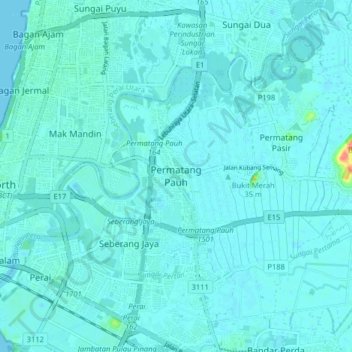
Name: Permatang Pauh topographic map, elevation, terrain.
Average elevation: 5 m
Minimum elevation: -1 m
Maximum elevation: 55 m
Other topographic maps
Click on a map to view its topography, its elevation and its terrain.
George Town
The jurisdiction of George Town covers an area of approximately 306 km2 (118 sq mi), encompassing the entirety of Penang Island and nine surrounding islets. George Town is slightly more than two-fifths the size of Singapore. The 295 km2 (114 sq mi) Penang Island has an uneven terrain with a mountainous…
Average elevation: 6 m