Geolocate

Ciliwung topographic map

Interactive map

Click on the map to display elevation.

About this map

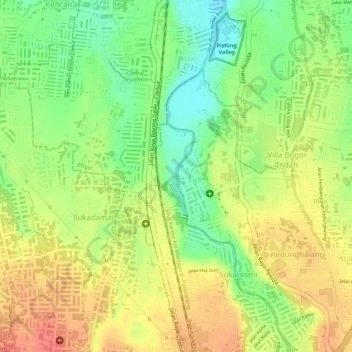
Name: Ciliwung topographic map, elevation, terrain.

Location: Ciliwung, Tanah Sareal, Bogor, West Java, Java, 16158, Indonesia (-6.54993 106.80107 -6.54298 106.80243)

Average elevation: 181 m

Minimum elevation: 148 m

Maximum elevation: 206 m

Mean rainfall reaches 3,125 mm, with a mean annual discharge of 16 m3/s as measured at Ciliwung Ratujaya observation station (231 km2). With such topographical, geological, and hydrological features, the Ciliwung River is often overflowing and inundating parts of Jakarta. The population along the Ciliwung River basin reaches 4.088 million (Census 2000) which can be regarded as the most densely populated area.

Wikipedia (CC-BY-SA 3.0)

Other topographic maps

Click on a map to view its topography, its elevation and its terrain.

Bogor

Indonesia > West Java > Bogor

Bogor, West Java, 16121, Indonesia

Average elevation: 442 m

Cibuluh

Indonesia > West Java > Bogor

Cibuluh, Bogor, West Java, 16153, Indonesia

Average elevation: 201 m

Citeureup

Indonesia > West Java > Bogor

Citeureup, Bogor, West Java, 16640, Indonesia

Average elevation: 425 m

Gunung Pancar

Indonesia > West Java > Bogor

Gunung Pancar, Bogor, West Java, Indonesia

Average elevation: 479 m