
Lansdale topographic map
Interactive map
Click on the map to display elevation.
About this map
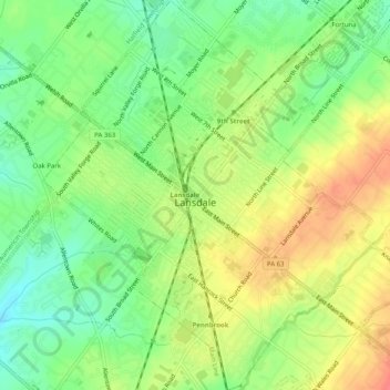
Name: Lansdale topographic map, elevation, terrain.
Average elevation: 108 m
Minimum elevation: 80 m
Maximum elevation: 138 m
Other topographic maps
Click on a map to view its topography, its elevation and its terrain.
Jenkintown
Vereinigte Staaten von Amerika > Pennsylvania > Montgomery County
Jenkintown, Montgomery County, Pennsylvania, Vereinigte Staaten von Amerika
Average elevation: 85 m