
Thank you for supporting this site ❤️
Make a donation
Make a donation
Rehobeth topographic map
Click on the map to display elevation.
Thank you for supporting this site ❤️
Make a donation
Make a donation
About this map
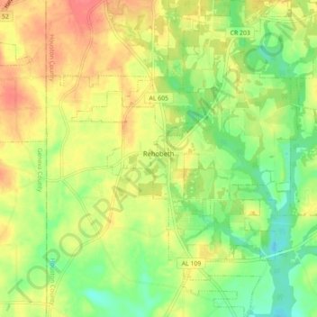
Name: Rehobeth topographic map, elevation, terrain.
Location: Rehobeth, Houston County, Alabama, United States (31.08429 -85.47847 31.16912 -85.41259)
Average elevation: 77 m
Minimum elevation: 47 m
Maximum elevation: 108 m
Thank you for supporting this site ❤️
Make a donation
Make a donation
Other topographic maps
Click on a map to view its topography, its elevation and its terrain.