
Hanley topographic map
Click on the map to display elevation.
About this map
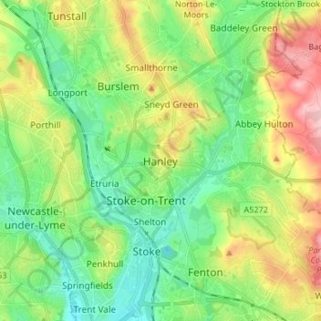
Name: Hanley topographic map, elevation, terrain.
Location: Hanley, Stoke-on-Trent, England, ST1 1LD, United Kingdom (52.98599 -2.21537 53.06599 -2.13537)
Average elevation: 154 m
Minimum elevation: 101 m
Maximum elevation: 251 m