
Gemeinde Nauders topographic map
Interactive map
Click on the map to display elevation.
About this map
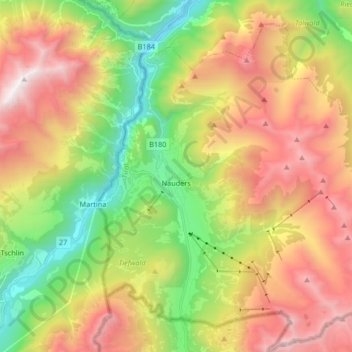
Name: Gemeinde Nauders topographic map, elevation, terrain.
Location: Gemeinde Nauders, Bezirk Landeck, Tyrol, 6543, Austria (46.83727 10.46468 46.95061 10.62429)
Average elevation: 2,028 m
Minimum elevation: 977 m
Maximum elevation: 3,031 m