
Thank you for supporting this site ❤️
Make a donation
Make a donation
Muscadine topographic map
Click on the map to display elevation.
Thank you for supporting this site ❤️
Make a donation
Make a donation
About this map
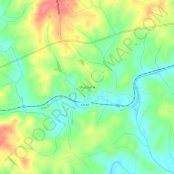
Name: Muscadine topographic map, elevation, terrain.
Location: Muscadine, Cleburne County, Alabama, 36269, United States (33.71455 -85.40607 33.75455 -85.36607)
Average elevation: 309 m
Minimum elevation: 276 m
Maximum elevation: 358 m
Thank you for supporting this site ❤️
Make a donation
Make a donation
Other topographic maps
Click on a map to view its topography, its elevation and its terrain.