
Thank you for supporting this site ❤️
Make a donation
Make a donation
De Kalb topographic map
Click on the map to display elevation.
Thank you for supporting this site ❤️
Make a donation
Make a donation
About this map
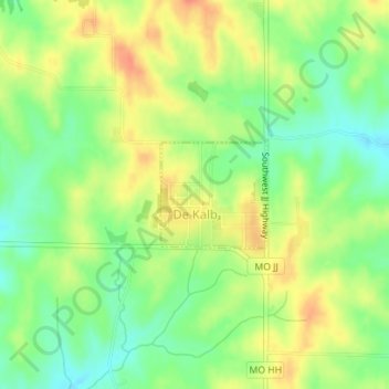
Name: De Kalb topographic map, elevation, terrain.
Location: De Kalb, Buchanan County, Missouri, United States (39.58457 -94.92837 39.59191 -94.91883)
Average elevation: 337 m
Minimum elevation: 313 m
Maximum elevation: 361 m
Thank you for supporting this site ❤️
Make a donation
Make a donation
Other topographic maps
Click on a map to view its topography, its elevation and its terrain.