
Thank you for supporting this site ❤️
Make a donation
Make a donation
Eden Valley topographic map
Click on the map to display elevation.
Thank you for supporting this site ❤️
Make a donation
Make a donation
Eden Valley
Eden Valley is a small South Australian town in the Barossa Ranges. It was named by the surveyors of the area after they found the word "Eden" carved into a tree. Eden Valley has an elevation of 460 metres and an average annual rainfall of 716.2mm. Eden Valley is in the Barossa Council local government area, the state electoral district of Schubert and the federal divisions of Barker and Mayo.
Thank you for supporting this site ❤️
Make a donation
Make a donation
About this map
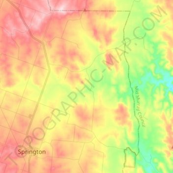
Name: Eden Valley topographic map, elevation, terrain.
Average elevation: 369 m
Minimum elevation: 221 m
Maximum elevation: 505 m
Thank you for supporting this site ❤️
Make a donation
Make a donation
Other topographic maps
Click on a map to view its topography, its elevation and its terrain.