
Thank you for supporting this site ❤️
Make a donation
Make a donation
Gaiola topographic map
Click on the map to display elevation.
Thank you for supporting this site ❤️
Make a donation
Make a donation
About this map
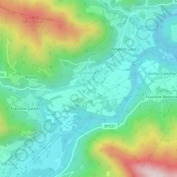
Name: Gaiola topographic map, elevation, terrain.
Location: Gaiola, Cuneo, Piedmont, Italy (44.32075 7.38674 44.34473 7.42480)
Average elevation: 795 m
Minimum elevation: 629 m
Maximum elevation: 1,207 m
Thank you for supporting this site ❤️
Make a donation
Make a donation
Other topographic maps
Click on a map to view its topography, its elevation and its terrain.