
Aiguamúrcia topographic map
Interactive map
Click on the map to display elevation.
About this map
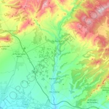
Name: Aiguamúrcia topographic map, elevation, terrain.
Location: Aiguamúrcia, Alt Camp, Tarragona, Catalunha, 43815, Espanha (41.31887 1.33752 41.40562 1.53796)
Average elevation: 473 m
Minimum elevation: 217 m
Maximum elevation: 979 m
Other topographic maps
Click on a map to view its topography, its elevation and its terrain.
Vila-rodona
Espanha > Catalunha > Alt Camp
Vila-rodona, Alt Camp, Tarragona, Catalunha, 43814, Espanha
Average elevation: 308 m