
Sturgeon Bay topographic map
Interactive map
Click on the map to display elevation.
About this map
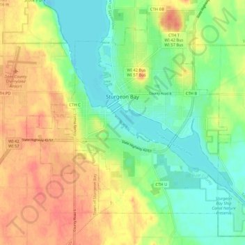
Name: Sturgeon Bay topographic map, elevation, terrain.
Location: Sturgeon Bay, Door County, Wisconsin, 54235, USA (44.79168 -87.41722 44.86064 -87.31081)
Average elevation: 199 m
Minimum elevation: 172 m
Maximum elevation: 229 m