
Oostduinkerke topographic map
Interactive map
Click on the map to display elevation.
About this map
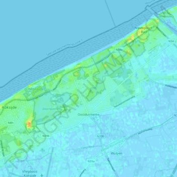
Name: Oostduinkerke topographic map, elevation, terrain.
Average elevation: 3 m
Minimum elevation: -3 m
Maximum elevation: 27 m
Other topographic maps
Click on a map to view its topography, its elevation and its terrain.
Koksijde
Belgium > West Flanders > Veurne > Koksijde
Koksijde, Veurne, West Flanders, Flanders, 8670, Belgium
Average elevation: 4 m