
Lac Jugon topographic map
Interactive map
Click on the map to display elevation.
About this map
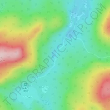
Name: Lac Jugon topographic map, elevation, terrain.
Average elevation: 516 m
Minimum elevation: 420 m
Maximum elevation: 698 m
Other topographic maps
Click on a map to view its topography, its elevation and its terrain.
La Vache Noire
Canada > Québec > Les Laurentides > Lac-Supérieur
La Vache Noire, Lac-Supérieur, Les Laurentides, Laurentides, Québec, Canada
Average elevation: 484 m