
Thank you for supporting this site ❤️
Make a donation
Make a donation
Dorfstraße topographic map
Click on the map to display elevation.
Thank you for supporting this site ❤️
Make a donation
Make a donation
About this map
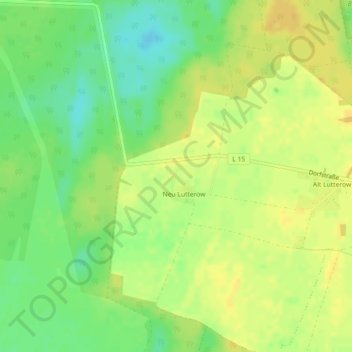
Name: Dorfstraße topographic map, elevation, terrain.
Average elevation: 89 m
Minimum elevation: 74 m
Maximum elevation: 99 m
Thank you for supporting this site ❤️
Make a donation
Make a donation
Other topographic maps
Click on a map to view its topography, its elevation and its terrain.
Großer Wummsee
Deutschland > Brandenburg > Ostprignitz-Ruppin > Rheinsberg > Flecken Zechlin
Average elevation: 72 m