
Berg topographic map
Interactive map
Click on the map to display elevation.
About this map
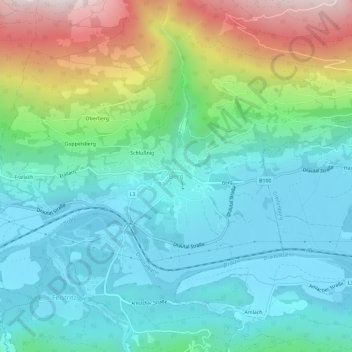
Name: Berg topographic map, elevation, terrain.
Average elevation: 843 m
Minimum elevation: 587 m
Maximum elevation: 1,558 m
Other topographic maps
Click on a map to view its topography, its elevation and its terrain.
Goppelsberg
Oostenrijk > Karinthië > Bezirk Spittal an der Drau > Berg im Drautal > Berg
Goppelsberg, Berg, Berg im Drautal, Bezirk Spittal an der Drau, Karinthië, 9771, Oostenrijk
Average elevation: 909 m