
Vila Chã de Ourique topographic map
Interactive map
Click on the map to display elevation.
About this map
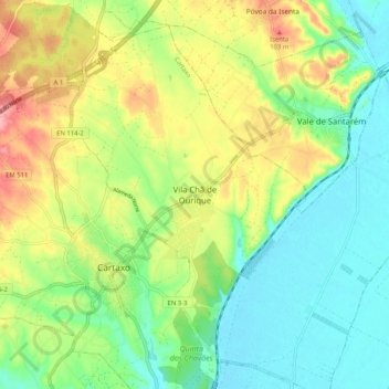
Name: Vila Chã de Ourique topographic map, elevation, terrain.
Location: Vila Chã de Ourique, Cartaxo, Santarém, 2070-628, Portugal (39.13688 -8.80479 39.21688 -8.72479)
Average elevation: 45 m
Minimum elevation: 1 m
Maximum elevation: 116 m
Other topographic maps
Click on a map to view its topography, its elevation and its terrain.
Vale da Pinta
Vale da Pinta, Cartaxo, Santarém, 2070-559, Portugal
Average elevation: 85 m