
Thank you for supporting this site ❤️
Make a donation
Make a donation
Mwanga topographic map
Click on the map to display elevation.
Thank you for supporting this site ❤️
Make a donation
Make a donation
About this map
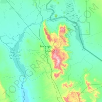
Name: Mwanga topographic map, elevation, terrain.
Location: Mwanga, Kilimanjaro, Northern Zone, Tanzania (-3.93960 37.41032 -3.43341 37.95635)
Average elevation: 843 m
Minimum elevation: 650 m
Maximum elevation: 2,088 m
Thank you for supporting this site ❤️
Make a donation
Make a donation