
River Bourne (Wiltshire) topographic map
Interactive map
Click on the map to display elevation.
About this map
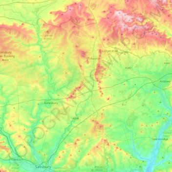
Name: River Bourne (Wiltshire) topographic map, elevation, terrain.
Average elevation: 116 m
Minimum elevation: 24 m
Maximum elevation: 267 m
Other topographic maps
Click on a map to view its topography, its elevation and its terrain.
Stratford-sub-Castle
United Kingdom > England > Wiltshire > Salisbury
Stratford-sub-Castle, Salisbury, Wiltshire, England, SP1 3LH, United Kingdom
Average elevation: 74 m