
Chancy topographic map
Interactive map
Click on the map to display elevation.
About this map
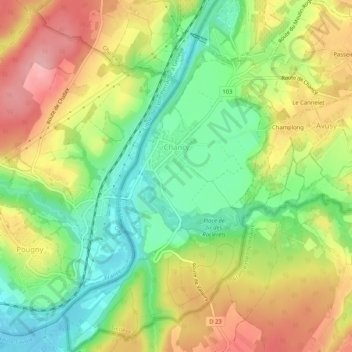
Name: Chancy topographic map, elevation, terrain.
Location: Chancy, Genf, 1284, Schweiz (46.12855 5.95591 46.16449 6.00581)
Average elevation: 392 m
Minimum elevation: 328 m
Maximum elevation: 465 m
Other topographic maps
Click on a map to view its topography, its elevation and its terrain.