
Dossãos topographic map
Interactive map
Click on the map to display elevation.
About this map
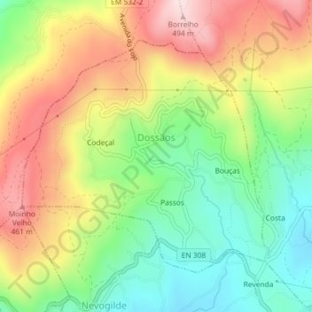
Name: Dossãos topographic map, elevation, terrain.
Location: Dossãos, Vila Verde, Braga, Cávado, Norte, Portugal (41.66845 -8.48397 41.68852 -8.45530)
Average elevation: 304 m
Minimum elevation: 150 m
Maximum elevation: 489 m