
Leitershofen topographic map
Interactive map
Click on the map to display elevation.
About this map
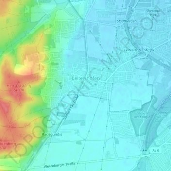
Name: Leitershofen topographic map, elevation, terrain.
Average elevation: 500 m
Minimum elevation: 484 m
Maximum elevation: 556 m
Other topographic maps
Click on a map to view its topography, its elevation and its terrain.
86391
Deutschland > Bayern > Landkreis Augsburg > Stadtbergen > Deuringen
86391, Deuringen, Stadtbergen, Landkreis Augsburg, Bayern, Deutschland
Average elevation: 514 m